Knob Island: Last Camp

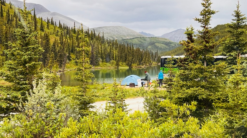
We’ve reached the end of our journey…Alsek lake. As we awoke yesterday morning, we busily broke camp, had breakfast and shoved off around 10:30am. We were glad to be out of “Purple Haze” camp due to the swarms of veracious mosquitoes that drove everybody mad. Dinner was a disaster! Dessert sat un-eaten as we all took refuge in our tents.

The sun broke out, in all its glory, the next morning and we all changed out of our layers and put on shorts and tank tops, for about 2 hours we soaked up the sun and stared at the ice capped mountains surrounding camp once again. 360 degrees of the most serene beauty one could imagine. Just when you think it can’t get any more stunning, the bar gets raised.

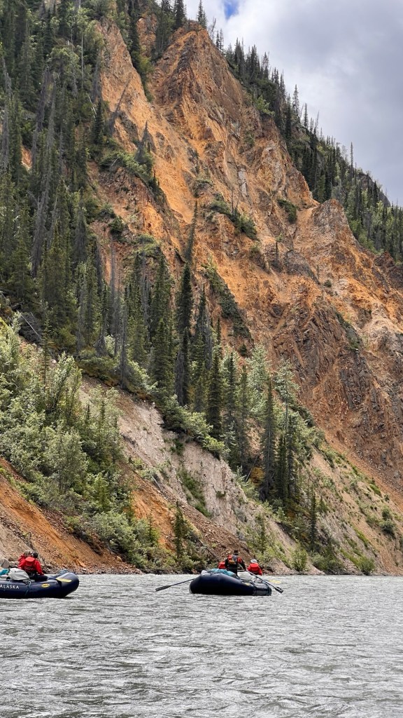
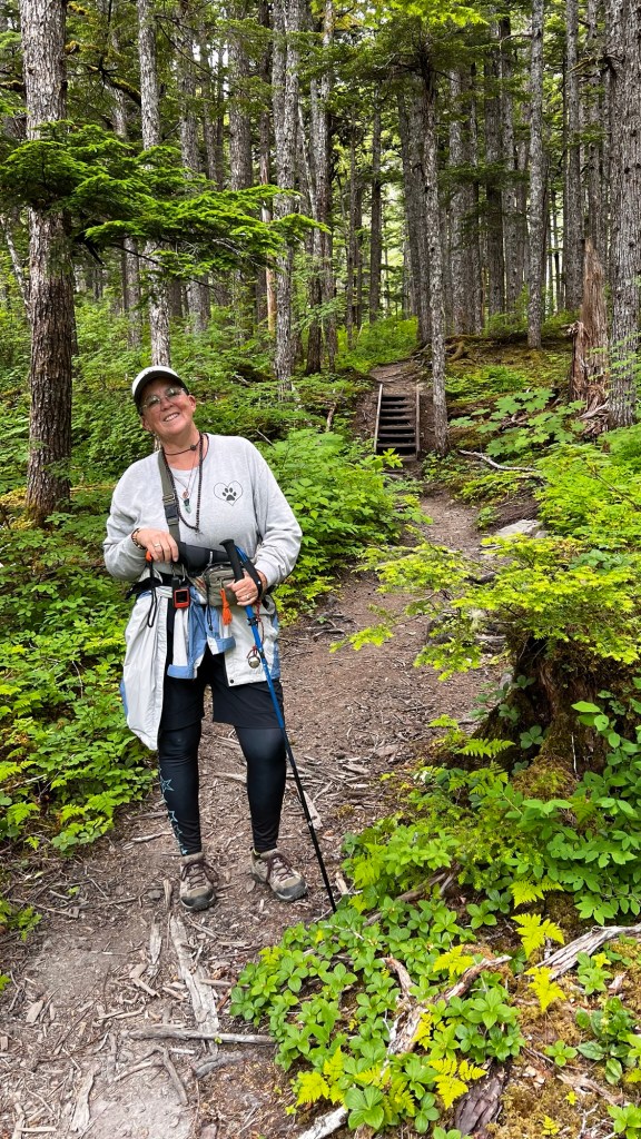
In the beginning of our trip, we encountered small burgie-bits. We had finally found glaciers! It was called Walker Glacier but you can no longer walk to or on it since it has receded and left a huge lake of little icebergs and a lot of tangled trees and muck, sticky, gooey muck. But today we’ve hit the mother load…Alsek Lake!

We spent all day watching the icebergs roll and calve. We even got to row the rafts around the icebergs floating in the bay. These things were massive and apparently can roll without notice. The tops that were exposed most of the time was the bluest blue you can imagine. As the sun shined through they would glow like a blue sapphire. The ones that rolled usually expose a rocky grey muddy bottom that has been dragged through the bottom of the lake.

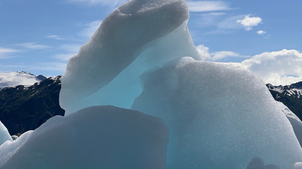
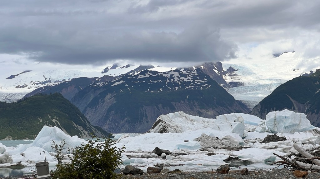
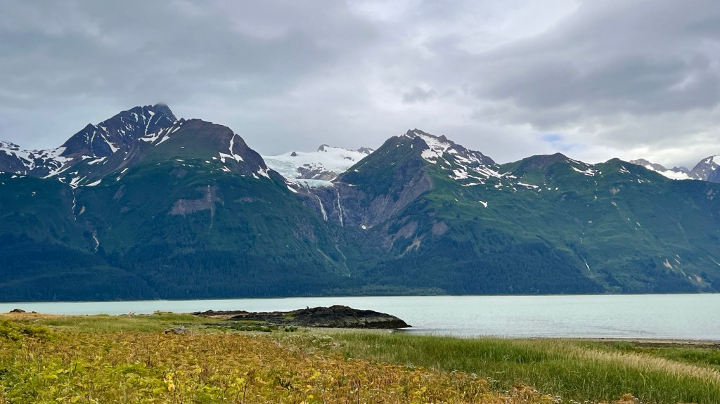
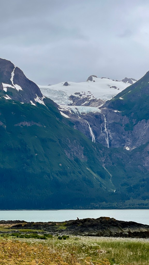
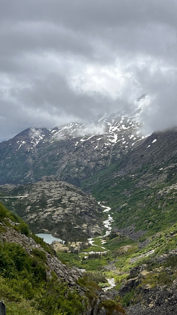
A glacier is an amazing thing. It can be blue or grey or white. Usually are thick and fill a deep crevice at the top of the mountains. Some come all the way down to the lakes and rivers; others have receded high into the mountain valley and formed formidable cliffs of ice.

The lake was in constant motion and we watched the icebergs as they journeyed their way, crashing into one another, creating deep thunderous scrapping sounds. It was quite eerie. Had the lake in front of our camp not been clogged with heavy berges, the waves set off by the turning and crashing into each other could have swamped the camp. Huge piles of logs marked the high water line, and we were told to set our tents up above the debris line.

Our last morning, we woke up to a thick layer of fog for our 4am wake up. We hurried to get out of camp and to Dry Bay for our flight extraction from there to Yukatat. We floated for about 2 hours in the fog with visibility under 50’. Arriving we disassemble the three rafts and broke down all the gear. A family with ATVs and trailers came to picked up the colorful piles of dry bags and coolers, paddles and oar frames.

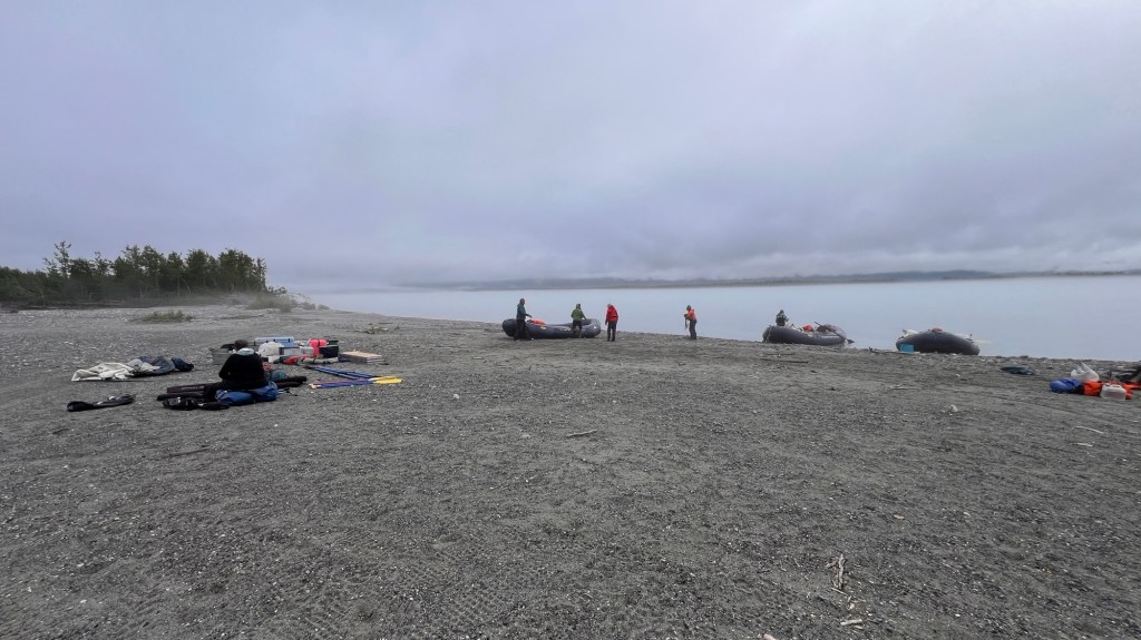
We all hurried about up and down the rocky beach, carrying whatever we could carry. Then hopped on the trailer and were taken to the airport, a gravel runway between a clearing of alders.

Arriving at the bush airport, we were told that the pilot that was coming to get us and his wife went out with a friend in his plane and had gone missing. Our pilot was not going to be able to pick us up nor was anyone else in the small village of Dry Bay. All pilots were running search and rescue.

So here we sit at the bush pilot airport. We will probably miss our flight to Juneau tonight.

Tatshashini River, Canada: Day One

I slept well last night even though I had some butterflies starting. 6:30am was our wake up time but neither of us made it that far. I woke up with a bit of a nervous stomach and it took a while for me to choke down some food but eventually I had talked enough that I began to settle down.

We woke to some sunny skies with just a hint of dark clouds draped high in the mountains. It seemed we had caught a break in the weather. At around 9am, we all piled in the van and set off for the river. The van ride took about an hour and a half, at best guess, since I retired my Apple Watch last night. The scenery was amazing…as always. We crossed the border from Alaska back into the Yukon about 45 miles from Haines.

It’s hard to put words to the depths of the greens covering the mountain sides. When the sun hits the trees the mountains glitter like big green emeralds surrounded in the most true blue sky and skillfully formed white clouds. Snow is draped in the crevasses like garlands on a tree. A wide river valley full of cobble stones and glacier melt full of streams and big rivers, lies between the road we are on and the mountain range.

The rain started again. In the distant canyon, a huge rainbow appeared as the sheets of rain funneled down from the mountain tops. We all took it as a sign. For the next half hour we drove in and out of the rain showers until the sun shown through the last of the black heavy clouds. Perhaps the rainbow was a sign.

We cut off on a steep, muddy dirt road and finally arrived at the river…but not before a bear decided to mozie on down the road in front of us. He reminded me of Gandaulf as he shook his boodie as he walked down the road like a runway model shaking his ass.

Arriving at the river, the guides were busily rigging the rafts. We were suited up, given a life jacket and a paddle, given the safety protocol talk and we were assigned boats and set off.

We were provided with dry paddle suits, top and bottoms, and top quality. The boats were 18’ NRS boats with extra large tubes. Two to a boat plus a guide. We got Carly the only woman guide. Queer thing, the participants are all women! Not planned in any way. All have experience on rivers all over the world, like Chris and I.

Over all, the river was gorgeous! Fast moving current propelled by fast glacier and snow melt. The rapids were quite plentiful, but we deliberately missed the wave trains as much as possible. The first wave that broke over the boat into my lap and down my dry suit was a quick and cold reminder why. The river runs in the high 30s to 40 degrees Fahrenheit. “When the wind blows,” as Andy, the lead guide said, “it’s like a fan blowing over an ice cube.”

Our first camp is situated on a stone bar on the right side of the river. The sun plays games with us and our comfort level. When it is out, it warms up quickly, so you take off a layer, then the wind blows off the river and you put a layer on. Hell, I’d had already met my fitness goals just from wardrobe changes. Today was a good trial for how to layer and how difficult it is to take one off or put one on.

Time for dinner and a well deserved nights sleep.

Rain and more rain

We woke up this morning to rain…not just a few pesky sprinkles like yesterday…but a steady down-pour. From the looks of it, it’s been raining all night. Forecast: 90% chance of rain all day. I say let it get it all wrung out of its system now before we hit the river.

We went to a local restaurant last night, the only one open in all of Haines. We sat up to the bar, since no tables were available. The waitress/bartender was running around waiting tables and tending bar. For almost 3 hours we watched her skillfully doing her job, not missing a beat. It took near 30 minutes or more to take our order and another hour plus for the food to come out. Back to small town speed.

A couple came in and settled in next to me. First, Henry, a First Nation member, then his girl friend, Carol, a white, small statured woman. They had so much advice for us, from what was good to eat, see, hikes, and so forth. They knew of the trip we were going on and told us it was a great trip. Apparently the company gives away a free trip to locals once a year. They also mentioned that the town hadn’t had any good rainfall in some time…wish granted…it’s raining.

Our journey to Haines took us on a ferry on the inside passage from Skagway to Haines. It took the best part of 3-4 hours for the loading, sailing and unloading in Haines. The trip was amazing. The views were more of the same…mountains climbing up out of the sea and scraping the sky. Some were draped in clouds spilling over the tops like a huge pillowy blanket. Most had veins of white snow outlined in groves of hemlock, birch and spruce.

As we approached Haines, a gigantic blue and white glacier appeared in a huge valley atop a mountain. The glacier looked miles thick from sea level and took on the typical pale blue of the glaciers. At the toe formed 2 huge waterfalls cascading down the mountain face and bursting into thin air as it plummeted over the edge. To the left was a river glacier. It curved around from a canyon inside the mountain and spilled into the bay. Just an amazing sight to behold.

We took a hike out to a point where we could see the bay and for miles up and down the fiords. We hiked through the most beautiful coastal rainforest. Thick hemlocks, spruce and birch trees stood along with thick thickets of devils club towering above our heads. We carried a machete, bear spray and bear bells to ward off any predators we might encounter. Maybe a bit of over kill but we also played the Carlos Naki native flute station down loaded on my phone, to warn anything we are coming. A little bear prevention goes a long way. The hike was beautiful and the final destination just took our breaths away.

A big animal den

Crossing borders

It’s been 12 days since we left Salt Lake City. Twelve days of constant driving, sleeping, hiking and driving some more. Yesterday, we crossed from Canada into Alaska. The grandeur of the views before us just kept getting more and more grand as we pushed through the rolling hills, and back to the Great Northern Rocky Mountains.

White Pass was a long mountainous pass with switchbacks and craggy glacier choked peaks jutting up from the valleys…with rivers flowing out of these behemoths in cascading waterfalls. Scattered snow melt lakes dotted the landscape, each with its own color of blue, green or milky white. The subalpine trees sprung up from rocky out crops and random high spots, stunted by the harsh winter months and many feet of snow. Small creatures darted from tree to tree, outcropping to outcropping. Birds flitted from tree to tree, with some doing crazy mid-air acrobatics, chasing insects we can’t see.

We exited the ALCAN Highway in Tagish, connecting with the Klondike Highway for our last push into Skagway, Alaska. The history along this stretch of road dates way back to the late 1800s when the gold rush took over this part of Canada and Alaska. The Tlingit people trapped this harsh land for survival. The Russians came to harvest what they could from the gold rich mountain streams and lakes and to buy pelts from the Tlingit people.

In 1942, the Alaska Highway was being completed which brought more and more people into the small villages and allowed for stores, saloons and hotels to spring up creating a booming mercantile market that allowed for easy sale of pelts and goods needed for gold mining. All this collapsed as the gold dried up. The roads to the villages still remained so the Tlingit continued to occupy the infrastructure that remained and created a lucrative trading business of beaver, lynx, bobcat and other large game animal hides. They supplied gas to westward travelers in their fancy new cars, a place to sleep and eat. Some of these towns, such as Dyea, have streets and street name signs, but the buildings have long since returned to the earth. Only trees, pictures on posts, and a boreal forest stand where the buildings once did. It is left to the imagination once again.

We chose to stay in the historic district/town of Dyea last night and tonight. Our camp sits on a tidal river. We learned that there are 22 different species of mosquito in Alaska, and I think we encountered half of them. A strong breeze did keep the rest of them away. We were entertained by a couple of bald eagles hunting on the tidal flats. We were not so amused by the little chipmunks that thought it would be fun to get up under the hood and strip some felt insulation off an intake for the fresh air by digging it off fuzzy piece by fuzzy piece. We decided to tape the shit out of it to prevent any more marauding.

Skagway

Today we packed up, went into town, and got showers at the Skagway Rec Center…much needed. You can pay $10 and stand under all the hot water you want! They even provide towels…bonus. Now all clean and wearing clean clothes, we are going to “paint the town” of Skagway.

Great Northern Rockies: Ravens and Bison and Bears…OH My…

We packed up camp this morning, everything was still damp from the previous days storms. It seems to rain a lot here. Last night, we camped near some natural hot springs. Laird hot springs was once a respite for the workers back in the 1940’s, building the Alaskan/Canada Highway, or ALCAN for short. The ALCAN took 9 months to build and was built by the US to service troops in Alaska during WW2. These natural hot springs flow into a beautiful river mixing to a perfect temperature. There’s a long half mile boardwalk to get to the springs, that crosses some swampy areas choked with peat and thick patches of lichen. The trees are sparse and mostly just tall skeletons, poisoned and bleached white by the sulphur and minerals leached from the hot springs.

After a good soak, we drove to the overflow camping lot and picked a spot. The campground had just filled up when we arrived, figures, and we were sold a spot in the overflow lot across the street from the official campground. Basically it was a big gravel parking lot with an outhouse and a fence. We settled in and slept well.

Throughout our trip thus far, we have encountered a myriad of animals. There is an abundance of black bears. It has become a norm to see at least one black bear grazing on the fresh green grasses on the wide swaths of treeless area between dense forest and Highway. We have also seen stone sheep, timber bison, a porcupine, huge black ravens and the normal rabbits and ground squirrels when we venture down a side road.

We ventured down a gravel road to see the beautiful Smith Creek Falls. It was such a beautiful sight, we decided to set up our chairs and sit by the edge of the cliff to finish our morning coffee. The sun was popping in and out of the cloud filled sky, a light breeze blowing and the thunderous sound of the immense falls all made for a devine spot to stop. We had just settled in when suddenly Chris says, in a low steady voice, “Bear…” Let me tell you the fear that grips you when you hear that word. My stomach instantly tensed up, a rush of adrenaline, we stood up, bear spray in hand, and started walking slowly, yelling and waving our arms as we headed for the van. The bear saw us and turned and ran back into the thick trees and shrubs as fast as we ran to the van. I must say that bear spray is now within constant reach and always on us when we go anywhere outside.

The landscape has changed again. We’ve been following the path of a wide river as it carves its way between towering peaks. The water takes in a milky white color as new rivers rush from high glaciers down into the swollen river basin. As it meanders along, the sun turns it the most beautiful pale blue as if the sky had just poured itself into the river. It’s not hard to see the powerful force that this water has, with huge trees, roots and all lying about, stranded on huge piles of boulders the size of a small car. Don’t be fooled by its tranquil appearance. At times, this river is a torrent of icy froth and foam, seething and grabbing whatever finds its way into its banks and tossing it like a toy. Amazing and deadly in one package.

Stone Mountain, Summit Lake, BC, Canada

We’ve got under 500 miles to go before our turnoff to Skagway. Today’s been a long slog across rolling hills and thickly forested landscape. The rain came down heavy almost from the time we hit the road. The burn scars became more and more prevalent as we came up to Fort Nelson, which is where you finally turn WNW towards Alaska.

It is incredible how straight roads can be. The roads are just tar strips atop a berm built up to aide in run off. These ribbons of black go for miles on end, or perhaps more fitting, kilometers on end, cut through a huge swath of trees. This is by design I’m guessing, to avoid vehicle big game accidents. I’ve heard a story of a guy who watched an elk and calf bolt out of the thick forest and straight across the road in front of him. He didn’t see the bear chasing them until he slammed in his brakes to avoid a deadly collision with it.

There are mystery roads all over. Dirt roads that just veer off into the thick vegetation. No signage and no squiggly line on the gps. Sometimes you can see a river or a lake as you blast by, but other times they just go into the darkness.

Provençal parks in Canada, are like our state parks in the USA. They are dotted all over the map with no real rhyme or reason. Tonight we are at about 4200 feet/1280m. We just got back into the northern Rockies. The horizon changed radically from rolling hills to steep passes and snow capped jagged mountains. We picked a place called Stone Mountain Provençal Park and Summit Lake Campground. Had the weather cooperated, we could’ve blown up our pack rafts and paddled around for hours exploring the coves and shoreline. Perhaps in the morning, the sun will grace us with its shining face and we can start the day off with a paddle.